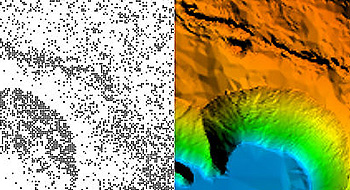
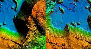
Atlass-Aerometrex is an innovative, Australian owned company delivering high definition surface data, stockpile volume calculations and aerial imagery. Since 2007 we have successfully serviced a wide range of clients throughout Australia from sectors including mining, oil and gas, forestry, water, government, natural resource management and land development.
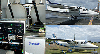
Customer Service: Most of our work is repeat business from clients who appreciate our quality deliverables, high level of customer service and fast-turn-around. For most surveys, clients receive their data within three working days of capture.
Innovation: Atlass-Aerometrex produces world class products and continues to innovate. We have invested resources developing software for the production of LiDAR products. LiDAR is a relatively new technology and where we discovered weaknesses in existing commercial software, we financed the development of our own processing and data management systems to work in conjunction with established software.
Equipment: Atlass-Aerometrex owns and operates two VULCANAIR P68C aircraft and a Harrier H68i LiDAR Unit with 80 megapixel camera.
We also have a backup H56 sensor and access to hire equipment and aircraft.
Location: We are based on the Queensland Sunshine Coast and our aircraft operate throughout Eastern & Central Australia, with regular surveys conducted in the Hunter Valley, NSW and the Bowen Basin, QLD.
Experience: Since 2007 we have carried out 1000's of aerial surveys and established a regular client base. This provides opportunities to group client surveys by location to enable shared mobilisation costs. Using aircraft and LiDAR to acquire surface and image data is cost effective and removes risks associated with ground surveys in hazardous areas.
Capacity: Our in-house expertise combined with the products and services available from the parent company, Aerometrex Pty Ltd, means we have a full range of spatial and image capabilities, including cutting edge 3D visualisation technologies, with access to additional aircraft and multiple digital aerial camera platforms.
Accuracy: At an average flying height of 700m AGL we offer 10cm vertical and horizontal accuracy, subject to ground control. Our H68i unit includes a built in 80megapixel camera which captures 'as is' imagery in conjunction with LiDAR surveys at up to 5cm image pixel.
|